
What it is
The Mauna Loa Summit Trail is a challenging backcountry hiking route leading to the summit caldera of Mauna Loa, the world's most massive active volcano, located on Hawaiʻi's Big Island. It offers a unique opportunity to explore a high-altitude, stark volcanic landscape. The true summit of Mauna Loa is at 13,679 feet (4,170 meters) above sea level.
There are typically two main approaches to reach the summit caldera: the Mauna Loa Trail, which starts within Hawaiʻi Volcanoes National Park, and the Observatory Trail, which begins at the Mauna Loa Observatory. Due to recent volcanic activity, access to the Mauna Loa summit has been limited, with the ʻĀinapō Trail currently being the only permitted access route. This route requires navigating through Kapāpala Ranch and the Kapāpala Forest Reserve.
Visitor experience
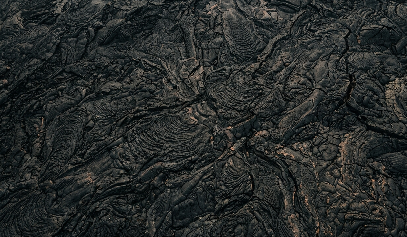
Hiking the Mauna Loa Summit Trail is an arduous but rewarding experience through diverse ecosystems, from high-elevation forests to vast lava fields and cinder cones. Hikers will encounter rough, jagged, and often loose lava rock terrain, marked primarily by cairns (stacked rocks), which can be difficult to follow in low visibility. The immense scale of the Mokuʻāweoweo caldera at the summit is often described as breathtaking. The trail is entirely exposed to the sun with no shade.
The hike typically involves a significant elevation gain, starting at around 11,000 feet and ascending to over 13,600 feet. Many consider it the most difficult hike in Hawaiʻi due to the rough lava, high altitude, and demanding physical exertion. Hikers should be prepared for a long journey, potentially 12+ hours for a day trip or an overnight stay using one of the backcountry cabins.
Logistics
Area and Access: The Mauna Loa Summit Trail is primarily within Hawaiʻi Volcanoes National Park (HVNP) and accessed via other state lands. As of recent updates, the summit is exclusively accessible via the ʻĀinapō Trail. This trail is reached via ʻĀinapō Road, a rough, unmaintained 4WD road passing through Kapāpala Ranch and Kapāpala Forest Reserve. The Mauna Loa Observatory Road, which historically provided access to the Observatory Trail, is a 17.5-mile sometimes one-lane paved road off Saddle Road (Hwy 200) that can be rough in areas.
Reservations and Permits: Two permits are required for hiking to the Mauna Loa Summit Cabin via the ʻĀinapō Trail: one from the National Park Service for the Mauna Loa Cabin ($10, plus park entrance fee, up to 12 people for up to three nights) and another state permit for overnight use of the ʻĀinapō Cabin at Halewai ($30 for Hawaiʻi residents; $50 for non-residents). Day use of the ʻĀinapō trail itself does not require a state permit, but hikers must register in advance for gate access through Kapāpala Ranch, typically at least three working days prior. Hikers intending to travel to the summit must also register beforehand at the Hawaiʻi Volcanoes National Park Backcountry Office.
Timing and Duration: A day trip to the summit from the Mauna Loa Observatory trailhead (when accessible) can be 12.6 miles round trip and is considered very difficult, requiring an early start. The full Mauna Loa Trail from within the park can be a 30+ mile journey that typically requires 3-5 days. From the ʻĀinapō Trailhead, it's a 2.7-mile hike to ʻĀinapō Cabin, then another 7.5 miles to Mauna Loa Summit Cabin.
Parking: Limited parking is available at the ʻĀinapō Trailhead. When using the Mauna Loa Observatory approach, parking is available in a lot offset from the observatory's climate monitoring gear.
Amenities: There are no services of any kind, including restrooms or reliable drinking water, along most of the trails. Backcountry cabins (Puʻuʻulaʻula/Red Hill Cabin and Mauna Loa Summit Cabin) offer basic amenities like sheltered space, sleeping quarters, composting toilets, and non-potable catchment water that must be treated before drinking.
Activity Type: This is an anchor activity, requiring significant planning, physical preparation, and dedicated time, often multiple days.
Safety and cautions
Altitude Sickness: Mauna Loa is a high-altitude environment, and altitude sickness is a serious risk that can affect anyone, regardless of physical condition. Symptoms can include headache, nausea, dizziness, and fatigue. The only cure is to descend. Acclimatization is highly recommended, potentially by spending nights at lower elevations before ascending. Scuba divers must wait at least 24 hours before ascending Mauna Loa to avoid decompression sickness ("the bends").
Weather: Expect extreme and rapidly changeable weather conditions, including strong winds, driving rain, and even snow at any time of year. Snow can be several feet deep and obscure the trail. Blizzard conditions and winds up to 100 mph or more have been forecast, leading to closures. Temperatures can be freezing (e.g., -3.7 °C / 25.4 °F at Mauna Kea Summit, which is nearby and similar elevation).
Volcanic Hazards: Mauna Loa is an active volcano. Eruptions can occur without warning. Hikers should stay away from lava flows and volcanic gases during an eruption. Current closures due to volcanic activity or related trail damage are possible; for example, the Mauna Loa Summit Cabin was not accessible from Mauna Loa Trail due to damage from the 2022 eruption. Always check the National Park Service website for current conditions and closures before planning a trip.
Navigation and Terrain: The trail is over rough, unstable, and often loose lava rock, marked by cairns (ahu) that can be difficult to see in fog or bad weather. Getting caught on the trail after dark is extremely dangerous due to the inability to follow the trail. There is essentially no vegetation for shade or shelter.
Remote Location: This is a wild, remote mountain with no public phones or transportation. Be entirely self-sufficient with plenty of food, water, and appropriate gear.
Road Conditions: The Mauna Loa Observatory Road can be rough. While some suggest a passenger car can carefully negotiate it, using a 4WD vehicle approved for such roads is highly recommended, especially given rental car contract clauses. The ʻĀinapō Road requires a high-clearance 4WD vehicle.
Editorial take
This hike is a formidable challenge for highly experienced and physically fit adventurers seeking a multi-day backcountry experience on one of the world's most impressive volcanoes. It's an anchor activity demanding extensive preparation for high altitude, extreme weather, and rugged, remote terrain. Those who prioritize solitude, epic volcanic landscapes, and a genuine test of endurance will find it profoundly rewarding.
Prioritize if: You are an experienced high-altitude hiker with excellent physical fitness, are prepared for multi-day self-sufficient trekking, understand and respect volcanic environments, and are seeking a wilderness experience away from crowds. You must be diligent about checking current conditions and permits.
Skip if: You are not an experienced hiker, are prone to altitude sickness, have limited time, are looking for a casual day hike, or prefer trails with established amenities and clear signage. This is not a "bucket list" item for the unprepared.
Do not confuse with:
- Mauna Kea Summit: While also a high-altitude summit on the Big Island, Mauna Kea is a dormant volcano primarily accessed by a paved road to observatories, with a much shorter summit hike, and is a significant cultural site. Mauna Loa is an active volcano with a vastly more challenging hiking experience.
- Kilauea Volcano: Kilauea is another active volcano within Hawaiʻi Volcanoes National Park, known for its frequent eruptions and more accessible viewing opportunities of active lava flows and craters (like Halemaʻumaʻu). Mauna Loa is much larger, higher, and its summit crater (Mokuʻāweoweo) offers a different, more remote type of volcanic experience.
- Mauna Loa Scenic Drive: There is a paved road (Mauna Loa Road) within Hawaiʻi Volcanoes National Park that leads to a lookout at a lower elevation than the summit, offering scenic views without the strenuous hike. This is a very different experience from the summit trail.
Source notes
- Hawaiʻi Volcanoes National Park - Mauna Loa: https://www.nps.gov/havo/planyourvisit/hike_maunaloa_maunaloa.htm
- Wanderlog - Mauna Loa Summit Trail: https://vertexaisearch.cloud.google.com/grounding-api-redirect/AUZIYQF7rnbWsHHYYe8NUNW2ZN1Ix3t8SBBLuBdz590N_oSHDYx2va0dR_5kyKTfjAb0kEEGfvUOGo5JuBAzgG8Z1k-RyQegb8KlfSlhHlOxElhN1K5_CV6yxRbmS65vbr3HcFmy0WQDLMjeWPXm6sknOY-wcMkPj0Fx8YwYApvB
- Big Island Hikes - Mauna Loa: https://www.bigislandhikes.com/mauna-loa
- Komoot - The best walks and hikes around Mauna Loa: https://vertexaisearch.cloud.google.com/grounding-api-redirect/AUZIYQHA60KBOzuOaOZPLyBtssoY8XOZJdwJ8RreEsIwYWIRcevp2eTRkX5OJ-HdjNRMPr3iokxhBwE62zOQdS-Ey5gNAFzWq62Xk0xjWXP6Zzu7ZTMmXXN95mXR6vKxDiBQryhR4p5tHMfZ2pVX9LFzJERHa8C8Xg==
- Hawaii Camping Reservation - ʻĀinapō Cabin: https://hawaiicamping.com/permits/ainapo-cabin-division-of-forestry-and-wildlife
- KinQuest.com - Mauna Loa Trail Guide: https://www.kinquest.com/hawaii/hikes/maunaloa.html
