
Summits & Saddle
The Big Island’s high, spare interior—summits, lava slopes, and the Saddle Road crossing.
Summits & Saddle is Hawaiʻi Island’s alpine-feeling middle: the broad saddle between Mauna Kea and Mauna Loa, plus the access route that links Kona/Kohala to Hilo/Hāmākua. Most visitors experience it as a purposeful drive—either crossing the island or making a Mauna Kea outing—where weather, elevation, and visibility matter more than towns or amenities.
Best For
- Mauna Kea sky viewing
- Dramatic volcanic landscapes
- Cross-island scenic drives
- Cooler high-elevation air
- Photographers chasing light
Trade-offs
- Thin services and fuel
- Cold wind after sunset
- Altitude affects some visitors
- Fast-changing conditions
Logistics & Getting Around
Treat this region as a drive-through and summit-access zone: start with full fuel, warm layers, and flexibility. Conditions can shift quickly with clouds and wind, and altitude can slow plans even when roads are clear.
Areas in Summits & Saddle
Signature Experiences in Summits & Saddle

A different Big Island: high, wide, and quiet
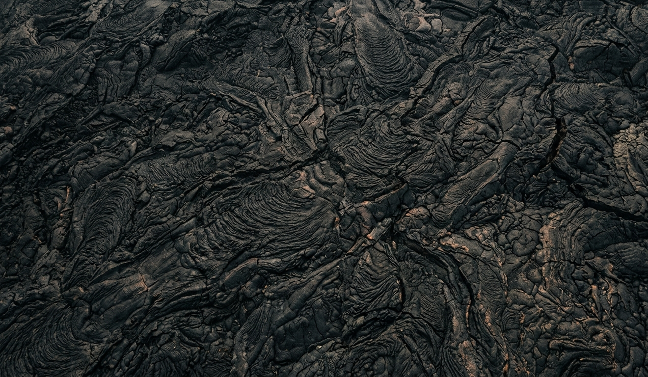
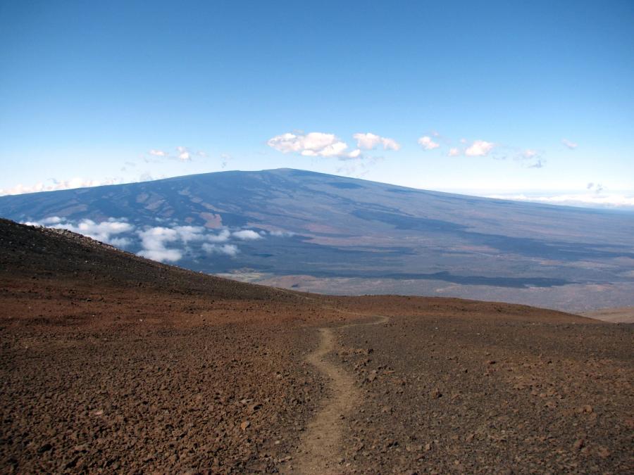
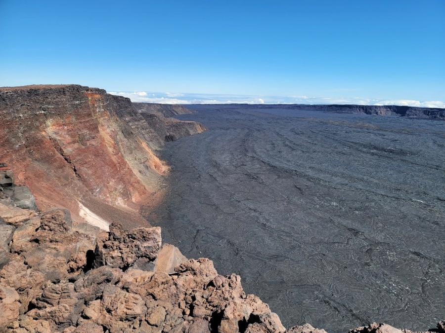
The Summits & Saddle region is the Big Island stripped to essentials—road, rock, sky. It sits between the island’s wetter east and drier west, running through the broad uplands between Mauna Kea and Mauna Loa. On clear days the scale is the first thing you notice: long slopes of dark lava, pale cinder and grasses, and horizons that feel more like the American West than a tropical island. On cloudy days, the landscape turns spare and atmospheric, with fog bands and sudden bursts of sun.
People rarely come here to “hang out.” They come with a specific intention: to cross the island efficiently on the Daniel K. Inouye Highway (Saddle Road), or to reach Mauna Kea’s visitor station and, conditions permitting, higher elevations for views and night skies. Either way, the experience is defined by elevation rather than shoreline—cool air, strong wind, and the sense that you’re traveling through a true interior.
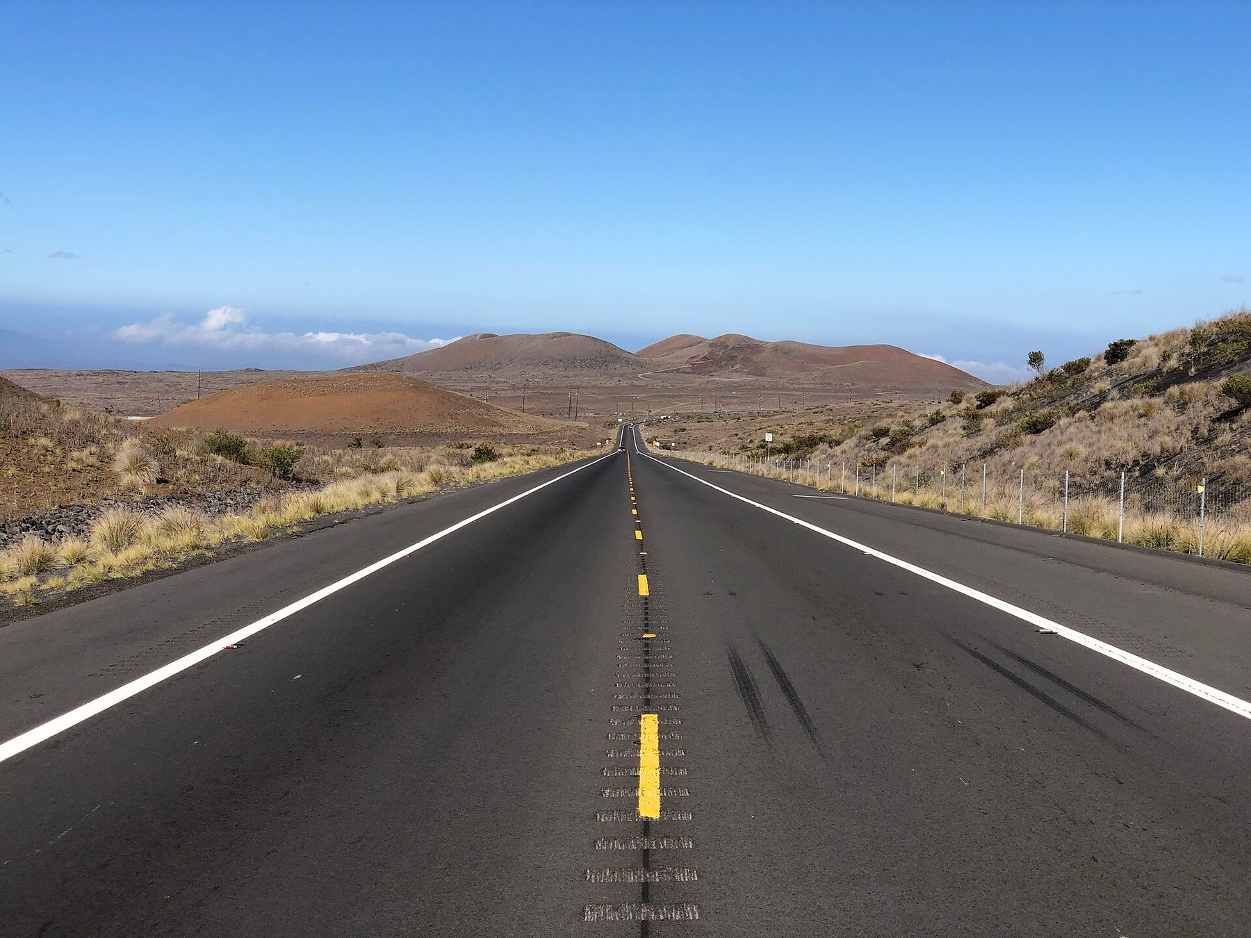
The Saddle Road corridor
As a drive, the Saddle is both practical and memorable. It’s the most direct connection between the Kona/Kohala side and Hilo/Hāmākua, and it passes through scenery that changes quickly: younger lava flows, older weathered fields, and broad, treeless stretches where clouds cast moving shadows. Pullouts and viewpoints can be brief but rewarding—good places to feel the temperature drop and see how the mountains hold their own weather.
This is not a services corridor. Plan like you’re heading into a backcountry zone: have what you need with you, and don’t count on last-minute options for food, fuel, or supplies.
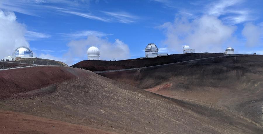
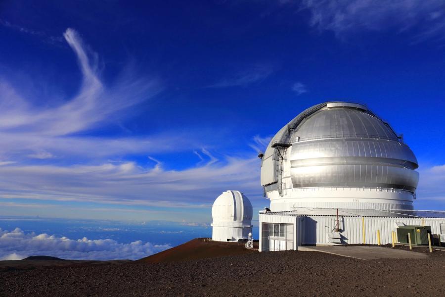
Mauna Kea: altitude, light, and restraint
Mauna Kea is the region’s main draw, and it comes with built-in pacing. Many visitors stop at the Mauna Kea Visitor Information Station to acclimate, learn about conditions, and decide how far to go. Even without reaching the top, the setting is powerful—big views across the saddle, a clearer sense of the volcano’s scale, and, after dark, some of the most vivid skies most travelers will ever see.
The tradeoffs are real: altitude can affect anyone, temperatures can plunge quickly, and weather can close in with little warning. If you approach Mauna Kea with patience—allowing time, dressing for winter-like wind, and being willing to turn around when visibility or comfort drops—the experience feels less like ticking off a viewpoint and more like visiting a rare environment.
How it fits into a trip
Most itineraries touch Summits & Saddle in short, concentrated bursts: an afternoon-and-evening Mauna Kea outing, or a daylight crossing between coasts with a few stops. It’s best treated as a powerful interlude between beach towns—an interior that reshapes your sense of the island’s size and climate, then gives you back to the shoreline.

Can't decide where to stay? Get personalized advice.
Custom recommendations built from the web's most comprehensive Kauai guide.