
Kaʻū
A big-sky southern district where Volcano and empty coastline define the pace.
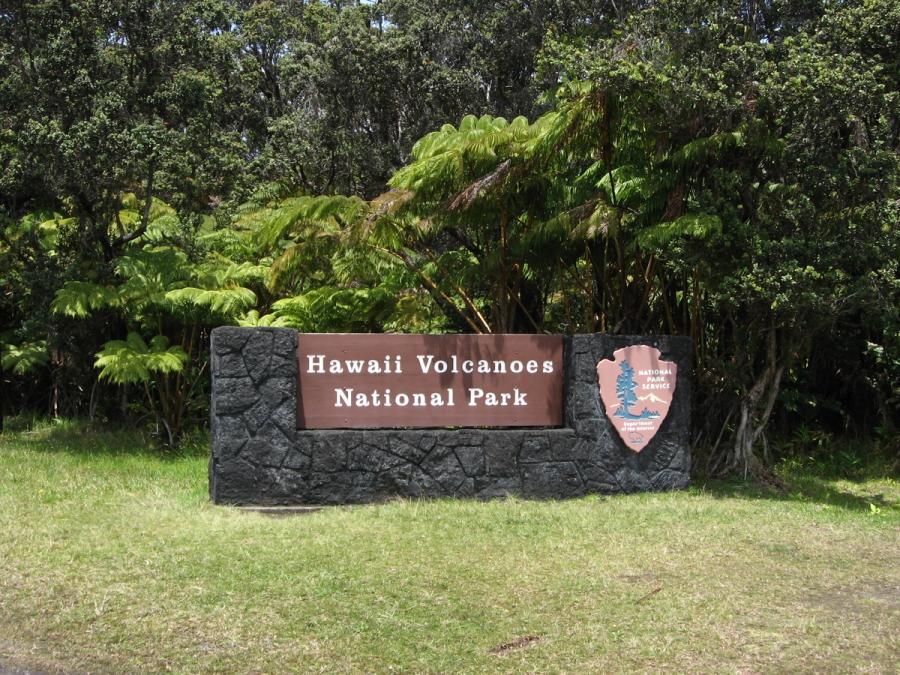
Kaʻū stretches across the Big Island’s south, and in this guide it explicitly includes Volcano and the Hawaiʻi Volcanoes National Park gateway. Expect cool, misty uplands around Volcano House, then long drives to wide-open coastlines, black-sand shorelines, and stark lava landscapes. It’s more about land and distance than towns and shopping.
Best For
- Hawaiʻi Volcanoes access
- Scenic south-coast drives
- Black-sand beach stops
- Quiet rural Hawaiʻi
- Big landscape photography
Trade-offs
- Long gaps between services
- Rapid weather shifts
- Limited town nightlife
- Windy exposed coast
Logistics & Getting Around
Bring a full tank and a flexible mindset: distances are bigger than they look, and conditions vary sharply between cool, wet elevation at Volcano and warmer, windier shoreline. Plan food, water, and daylight around the drives.
Areas in Kaʻū
Signature Experiences in Kaʻū
The feel of Kaʻū: elevation, lava, and space
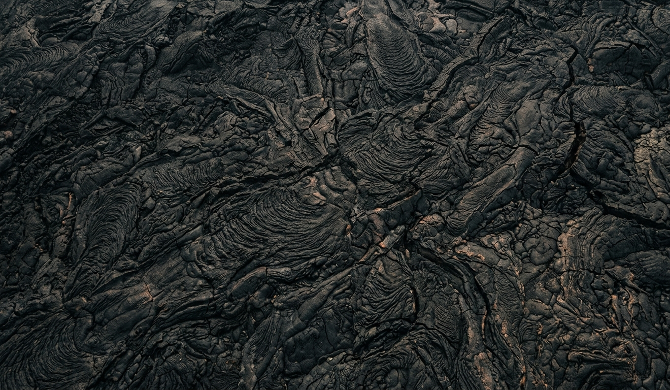
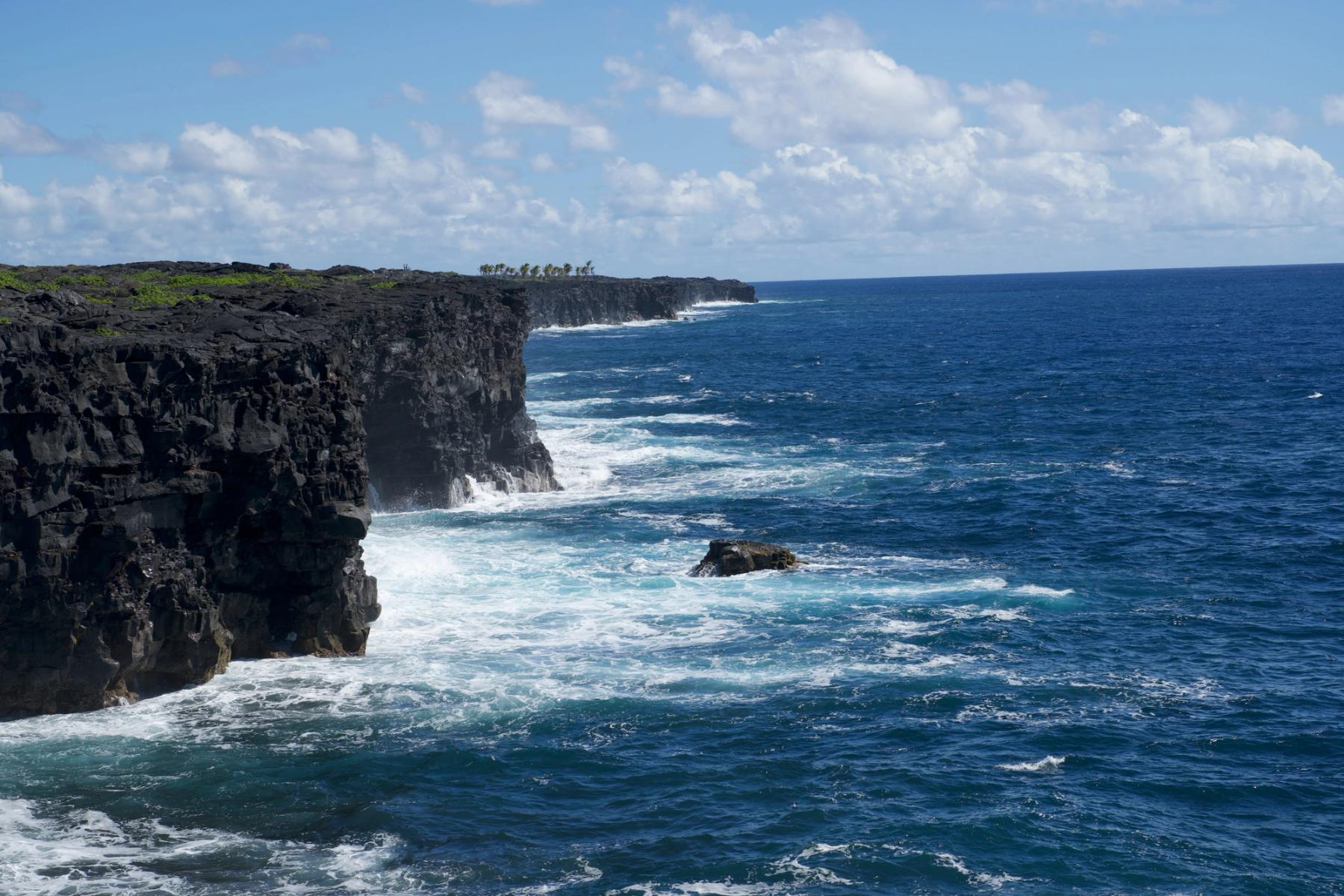
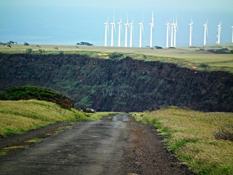
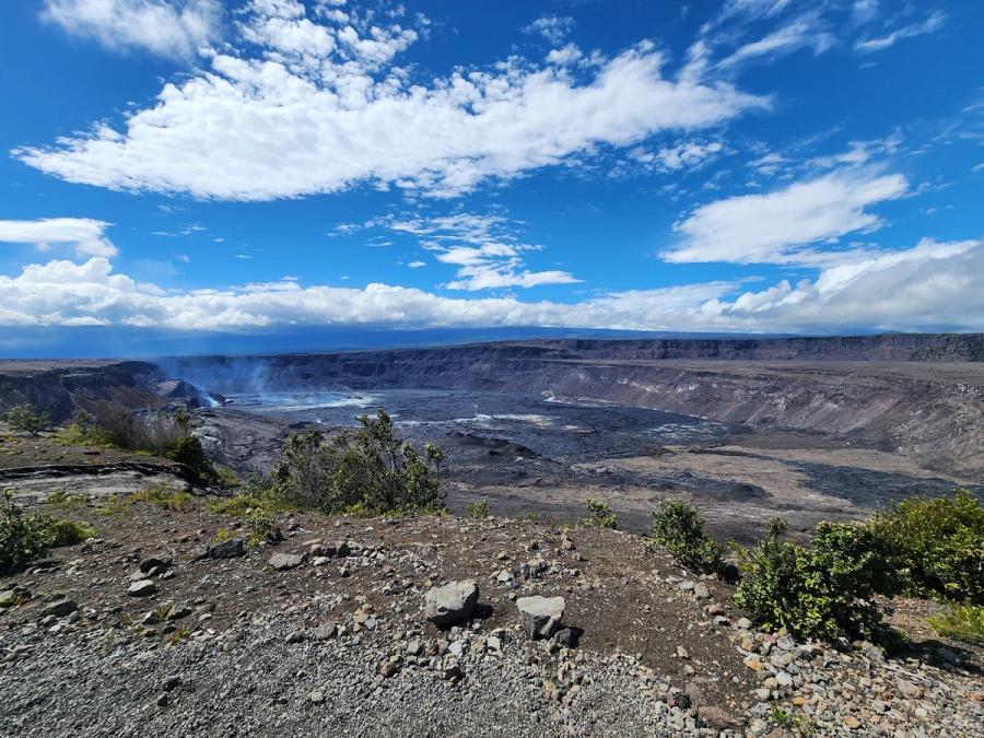
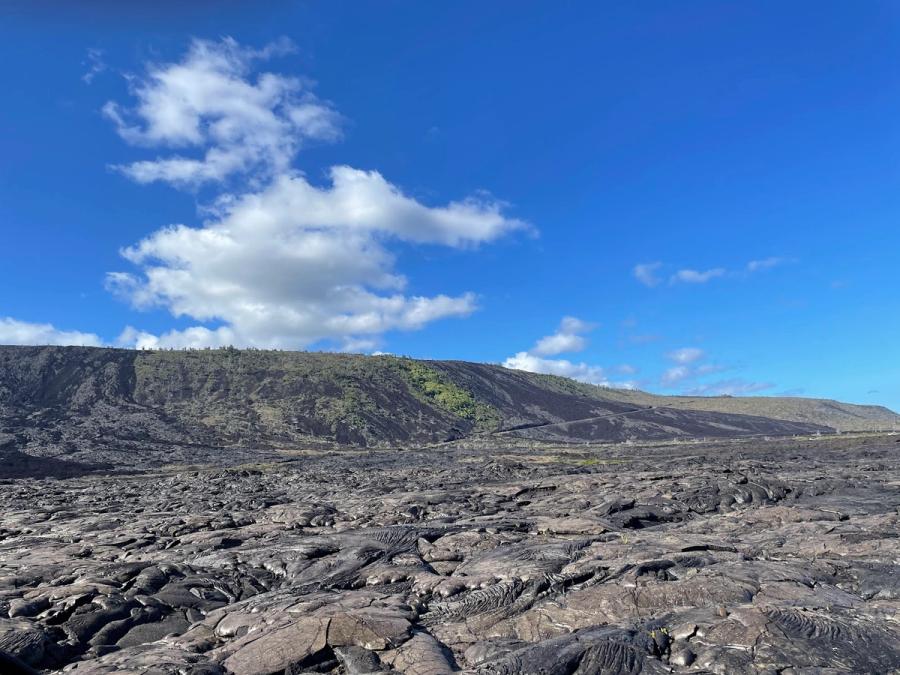
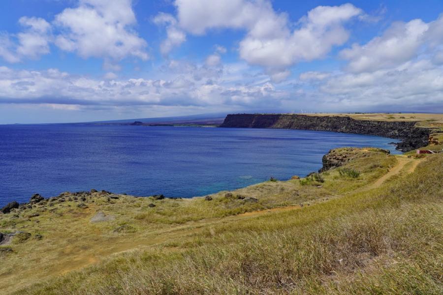
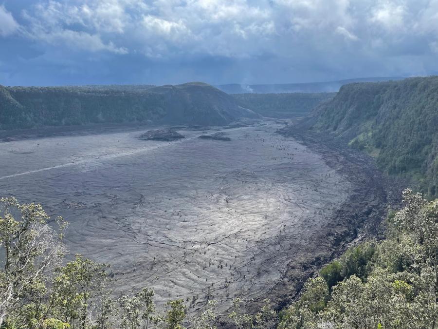
Kaʻū is the Big Island’s southern district, a place where the landscape does most of the talking. In this guide’s map, Kaʻū includes Volcano—the cool, high-elevation village and the main gateway to Hawaiʻi Volcanoes National Park—so the region naturally spans two very different moods. Up high, the air can be damp and chilly, with ʻōhiʻa forests and a lived-in park-town feel around Volcano House. Down low, the south coast opens into wind, sun breaks, and long black-and-brown lava plains that make the island feel huge.
What visitors remember is the sense of scale: broad horizons, big skies, and stretches of road where you’re more likely to be watching clouds and light than scanning for the next attraction sign. This isn’t a resort strip. It’s a landscape you move through.
How people usually experience it
Most trips through Kaʻū follow one of two rhythms, and many combine both.
One rhythm is the Volcano hub. People come for early access to the national park, for the particular atmosphere of staying close to the crater landscapes, and for the simple convenience of being nearby when weather shifts or visibility changes. Even without overplanning, time here tends to be park-forward: overlooks, lava geology, and forested trails.
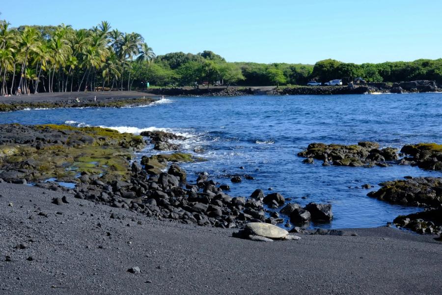
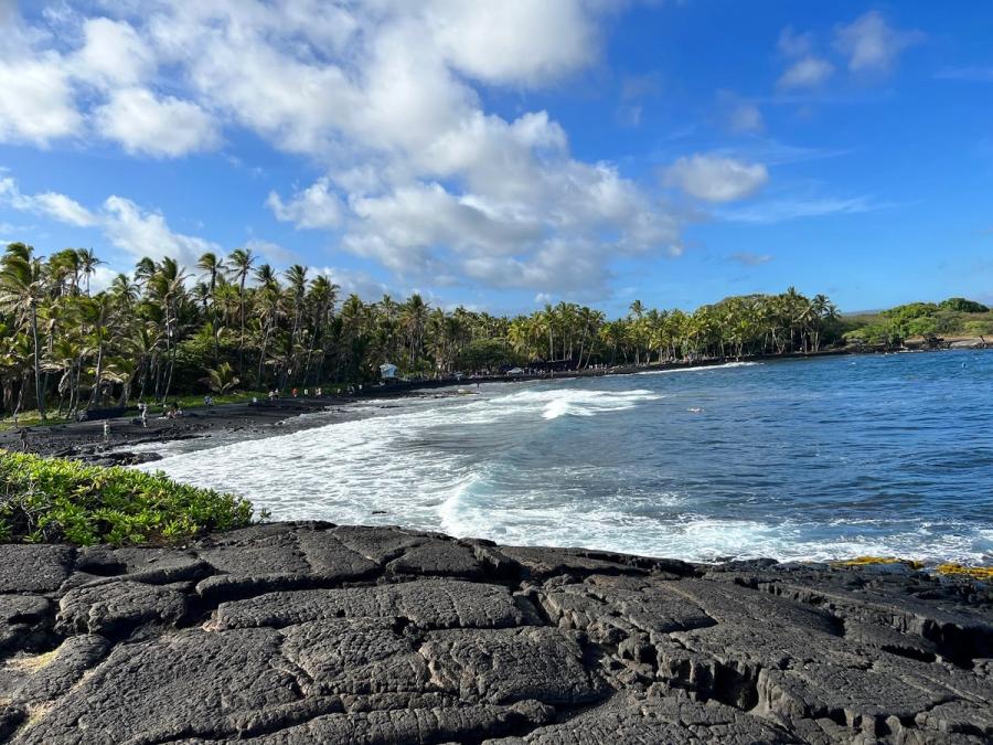
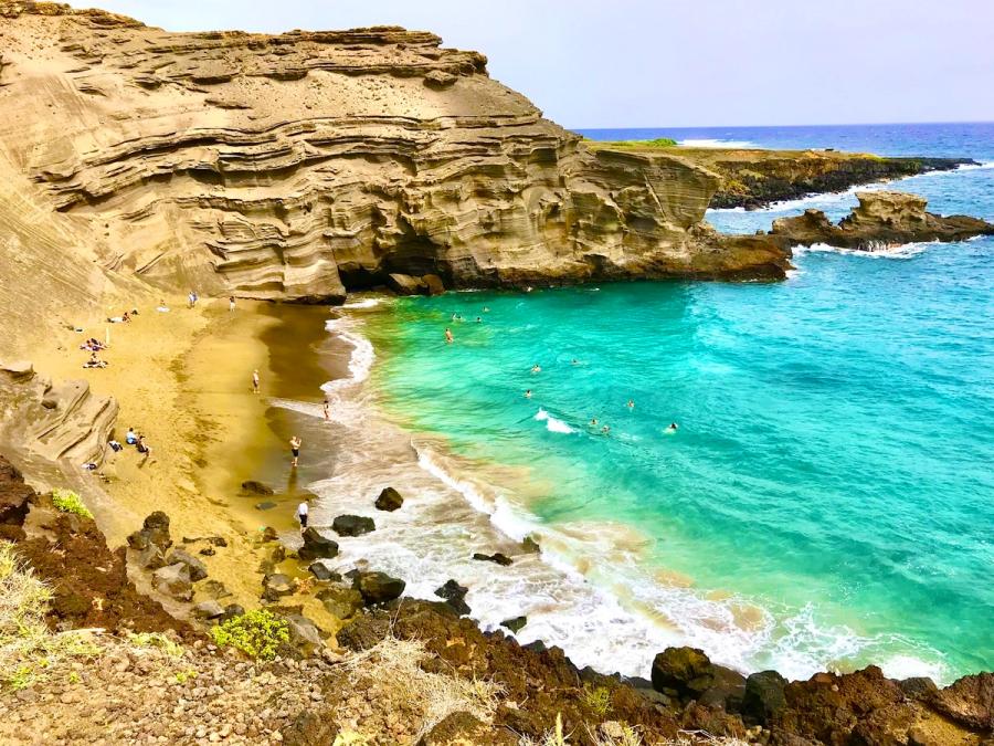
The other rhythm is the southern loop drive—a day of connected stops that links Kona and Hilo or adds variety to a volcano-focused stay. Punaluʻu Black Sand Beach is the classic pause: a dramatic shoreline where bright vegetation, dark sand, and surf make a striking contrast. It’s a good reminder that Kaʻū is not only about craters and elevation; it’s also about shoreline, currents, and the island’s younger edges.
South Point (Ka Lae) fits this same road-trip logic. It’s less a town destination than an out-and-back to the island’s exposed southern tip, where the wind and ocean feel powerful and unfiltered.
What to know before you go
Kaʻū rewards visitors who treat it as a place with real distances and limited conveniences. Services can be sparse between communities, and the weather can change quickly—especially when you move between Volcano’s uplands and the coast. Expect wind on exposed headlands, occasional rain at elevation, and a lot of time behind the wheel.
If you’re looking for dense dining choices, nightlife, or a beach day with easy amenities, you may find Kaʻū quiet. If you’re drawn to geology, atmosphere, and the feeling of traveling through Hawaiʻi’s rawer, less-built landscapes, this is one of the most distinctive parts of the island.


Can't decide where to stay? Get personalized advice.
Custom recommendations built from the web's most comprehensive Kauai guide.